Namosi Province (Namosi Province)
Namosi is one of Fiji's fourteen provinces and one of eight based in Viti Levu, the largest island. Located to the west of Suva, the province covers 570 square kilometers. Its population of 7,871 at the 2017 census was the second smallest of any Fijian province.
Namosi Province includes Namosi District, as well as the districts of Veivatuloa and Wainikoroiluva.
The province is governed by a Provincial Council, chaired by Ratu Kiniviliame Taukeinikoro. The Paramount Chieftain of Namosi is The Turaga Na Tui Namosi, Ratu Suliano Matanitobua.
Namosi has 1 Town within its boundaries shared with Serua Province which is Navua Town
Map - Namosi Province (Namosi Province)
Map
Country - Fiji
 |
 |
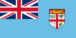
| Flag of Fiji | |
The majority of Fiji's islands were formed by volcanic activity starting around 150 million years ago. Some geothermal activity still occurs today on the islands of Vanua Levu and Taveuni. The geothermal systems on Viti Levu are non-volcanic in origin and have low-temperature surface discharges (of between roughly 35 and 60 C).
Currency / Language
| ISO | Currency | Symbol | Significant figures |
|---|---|---|---|
| FJD | Fijian dollar | $ | 2 |
| ISO | Language |
|---|---|
| EN | English language |
| FJ | Fijian language |


